



☰

Menu

×

Call 1-800-352-8088

More
Blank white page or empty document with no visible content
1-800-352-8088

What it's like

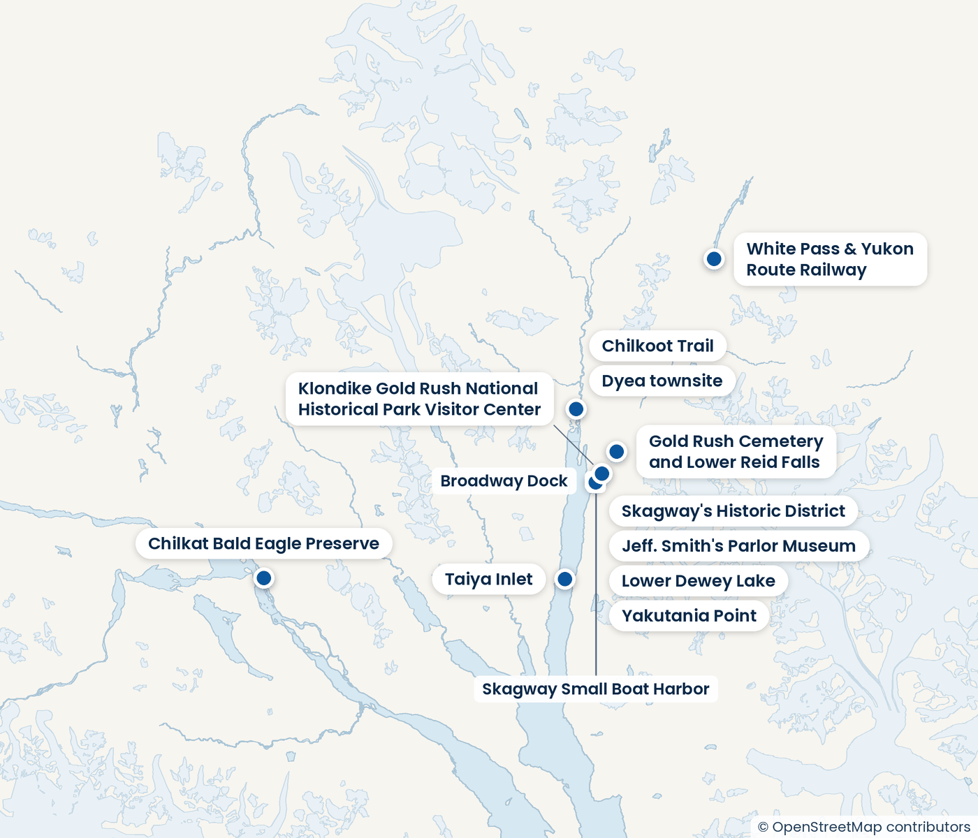
Yakutania Point is a low point on Taiya Inlet, just south of Skagway's airport terminal. It sits where the town's flat ground meets the water, and it is reached by a trail that starts close to the old waterfront streets.

A visit is simple. You walk out along the trail, cross the Skagway River on a footbridge, and reach the point with its view down Lynn Canal toward the Chilkat Mountains. A covered picnic shelter and a privy sit on the trail. The trail also joins Smuggler's Cove, so a walk can be extended.

Good to know

  • The city is level and only a few blocks wide, so you can walk to the trailhead without a taxi.
  • A covered picnic shelter and privy sit on the trail, so you can stop for lunch.
  • Shore anglers fish from points in Taiya Inlet such as this one.
A place to visit: ​
Viewpoint

Yakutania Point

A short walk from town to a point on Taiya Inlet, with a view down Lynn Canal toward the Chilkat Mountains. Trails, a footbridge and a picnic shelter make it an easy stop.
Whale watching
whale_watching
Glaciers and fjords
glaciers_fjords
Sport fishing
sport_fishing
Rainforest and jungle
rainforest_jungle
Museums
museums
Hiking
hiking
Ancient sites
ancient_sites
How to get there
Walk west along 1st Ave., turn left at Main St., go south two blocks, then follow the sidewalk west past the airport terminal.
Time needed
What it costs
Free to walk; the trail is open to the public with no entry fee given.
Suits
Walkers and hikers wanting easy views
{"bounds":{"east":-134.729579,"file":"place-sgy.png","north":59.827448,"proj":"EPSG:3857","px":[1400,1200],"south":59.168134,"west":-136.245087},"landmarks":[[59.4492082,-135.3216526,"Skagway Small Boat Harbor"],[59.4507041,-135.3237288,"Broadway Dock"]],"offmap_note":"Farther out, by boat or helicopter","whole":"The whole town"}
59.4527778
-135.3333333
{"acts":["scenic_views","hiking"],"doors":[],"lat":59.4527778,"lon":-135.3333333,"nearby":["SGY:dyea-townsite","SGY:lower-dewey-lake","SGY:chilkoot-trail","SGY:gold-rush-cemetery-and-lower-reid-falls"],"offmap":false,"spot":"SGY:yakutania-point","trips":[]}

Tours that go here

Prices are per person, booked with our partner, Shore Excursions Group.

No items found.
Next, in ​
Skagway
All of ​
Skagway
Ghost town

Dyea townsite

Skagway

The Dyea townsite is the remains of a gold rush boomtown at the head of the Taiya River Valley. Today it is a lush natural area where you walk among old ruins and wild plants.

Tours here from ​
​ a person
SGY:dyea-townsite
{"acts":["ancient_sites","scenic_views","hiking"],"doors":[],"lat":59.5077747,"lon":-135.3583274,"nearby":["SGY:lower-dewey-lake","SGY:yakutania-point","SGY:chilkoot-trail","SGY:gold-rush-cemetery-and-lower-reid-falls"],"offmap":false,"spot":"SGY:dyea-townsite","trips":[]}
59.5077747
-135.3583274
Trail and lake

Lower Dewey Lake

Skagway

Lower Dewey Lake is a moderate loop trail just outside Skagway's town center, leading through spruce and hemlock forest to a mountain lake. Most people walk it as a half day in the hills above town.

Tours here from ​
​ a person
SGY:lower-dewey-lake
{"acts":["hiking","scenic_views"],"doors":[],"lat":59.4448951,"lon":-135.3118399,"nearby":["SGY:dyea-townsite","SGY:yakutania-point","SGY:chilkoot-trail","SGY:gold-rush-cemetery-and-lower-reid-falls"],"offmap":false,"spot":"SGY:lower-dewey-lake","trips":[]}
59.4448951
-135.3118399
Trail

Chilkoot Trail

Skagway

The Chilkoot Trail is a historic route through the Coast Mountains, from the Dyea trailhead out toward Bennett in British Columbia. Most people here walk a short section or a day hike.

Tours here from ​
​ a person
SGY:chilkoot-trail
{"acts":["hiking","historic_towns"],"doors":[],"lat":59.5066237,"lon":-135.3463812,"nearby":["SGY:gold-rush-cemetery-and-lower-reid-falls","SGY:skagway-s-historic-district","SGY:klondike-gold-rush-national-historical-park-visitor-center","SGY:dyea-townsite"],"offmap":false,"spot":"SGY:chilkoot-trail","trips":[]}
59.5066237
-135.3463812
Trail and waterfall

Gold Rush Cemetery and Lower Reid Falls

Skagway

A short forest walk behind Skagway's old cemetery, ending at a view of Lower Reid Falls. It is an easy round trip that most people finish in about two hours.

Tours here from ​
​ a person
SGY:gold-rush-cemetery-and-lower-reid-falls
{"acts":["hiking","rainforest_jungle","historic_towns"],"doors":[],"lat":59.4737518,"lon":-135.2892677,"nearby":["SGY:chilkoot-trail","SGY:skagway-s-historic-district","SGY:klondike-gold-rush-national-historical-park-visitor-center","SGY:dyea-townsite"],"offmap":false,"spot":"SGY:gold-rush-cemetery-and-lower-reid-falls","trips":[]}
59.4737518
-135.2892677

The same kind of day, elsewhere

Sightseeing and scenic rides

Where it's best
Village

Oia

Santorini
Tours here from ​
$118.99
​ a person
Hill and viewpoint

Lycabettus Hill

Athens
Tours here from ​
​ a person
Waterfront district

Little Venice

Mykonos
Tours here from ​
$95
​ a person
Rock formations

Casibari and Ayo Rock Formations

Aruba
Tours here from ​
$99
​ a person